

So many tourists are already aware of the Thakek Loop and are searching for the next adventure off the beaten track. Many people are looking to the north of Laos to experience a more remote adventure. Travelling in a loop from Luang Prabang, Lao’s North East Loop offers riders a chance to explore more remote areas, award winning wildlife ecotourism tours, historical sites, ethnic groups, and incredible scenery. With more curves and climbs than the sedate Thakek Loop, this is a more challenging adventure for new riders, but an incredible journey into the remote Northern Laos. Read on to discover your next great adventure.
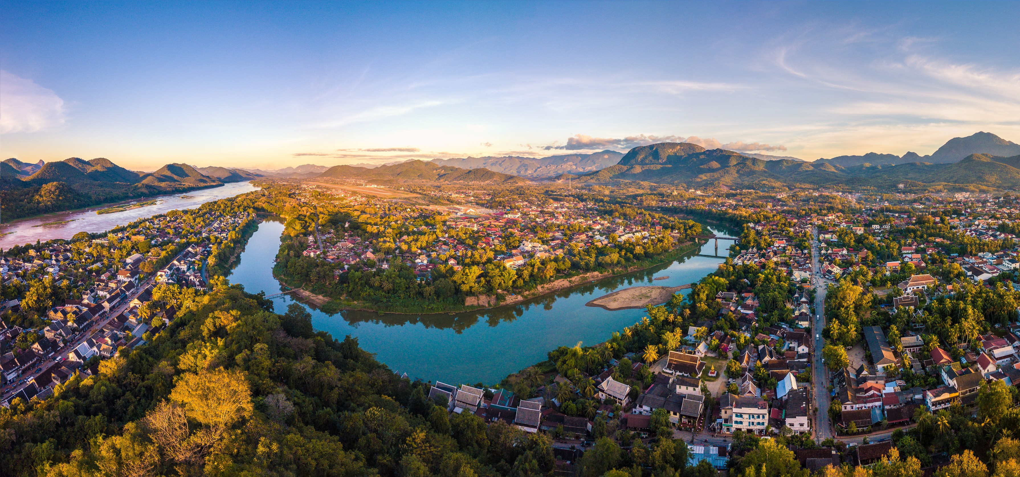
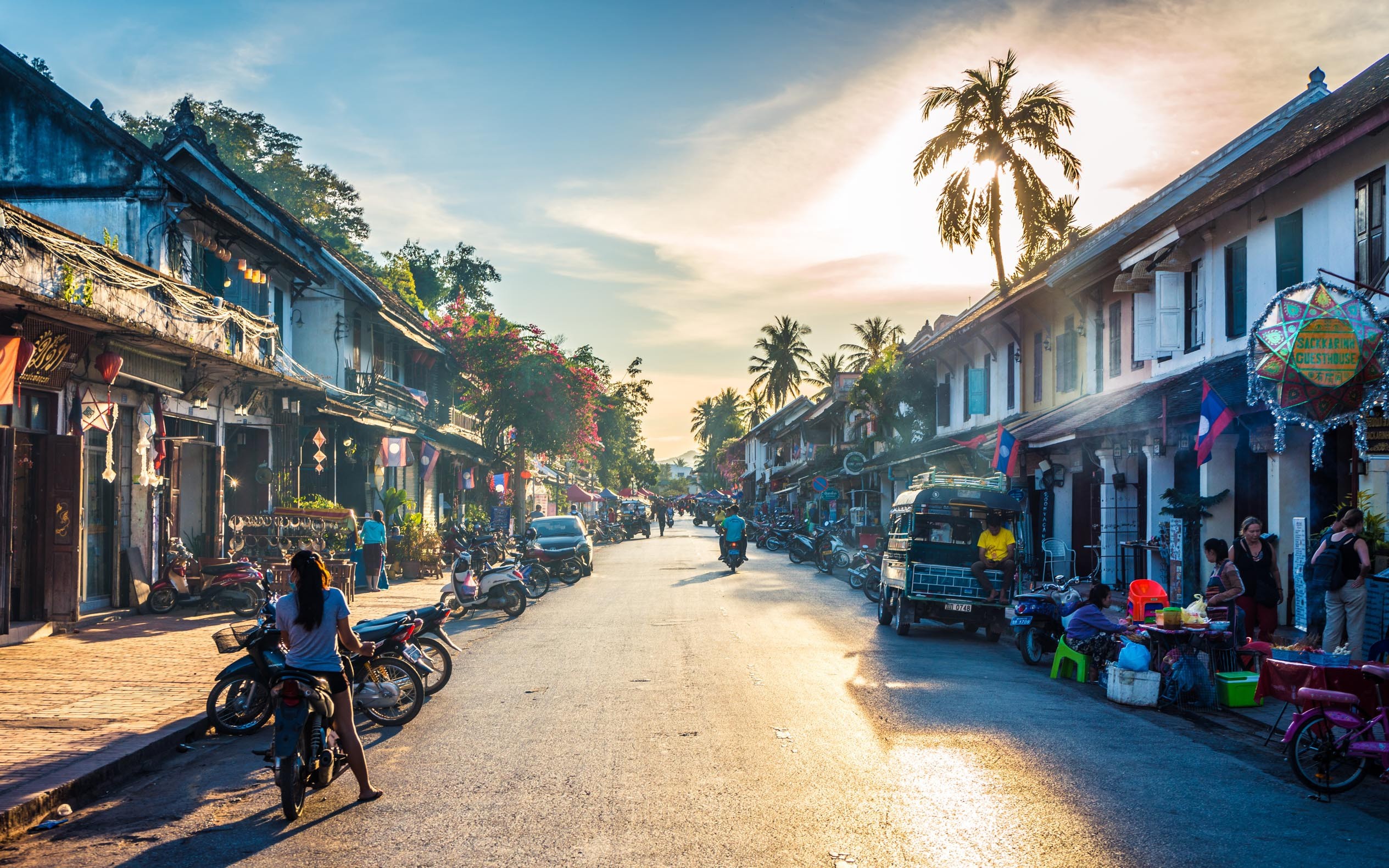
Starting your adventure in Luang Prabang there are plenty of great activities to keep you entertained and immerse you into Lao culture. The former royal capitol and UNESCO World Heritage City is one of the most popular tourist destinations in Laos and a great way to ease into your adventure. There are also plenty of places to rent motorbikes and scooters. Check out our article about riding bikes in Laos to get some great ideas about choosing a bike and getting ready to ride by clicking HERE. Once you’ve picked out your bike and you’ve spent enough time exploring Luang Prabang, then it’s finally time to hit the road.
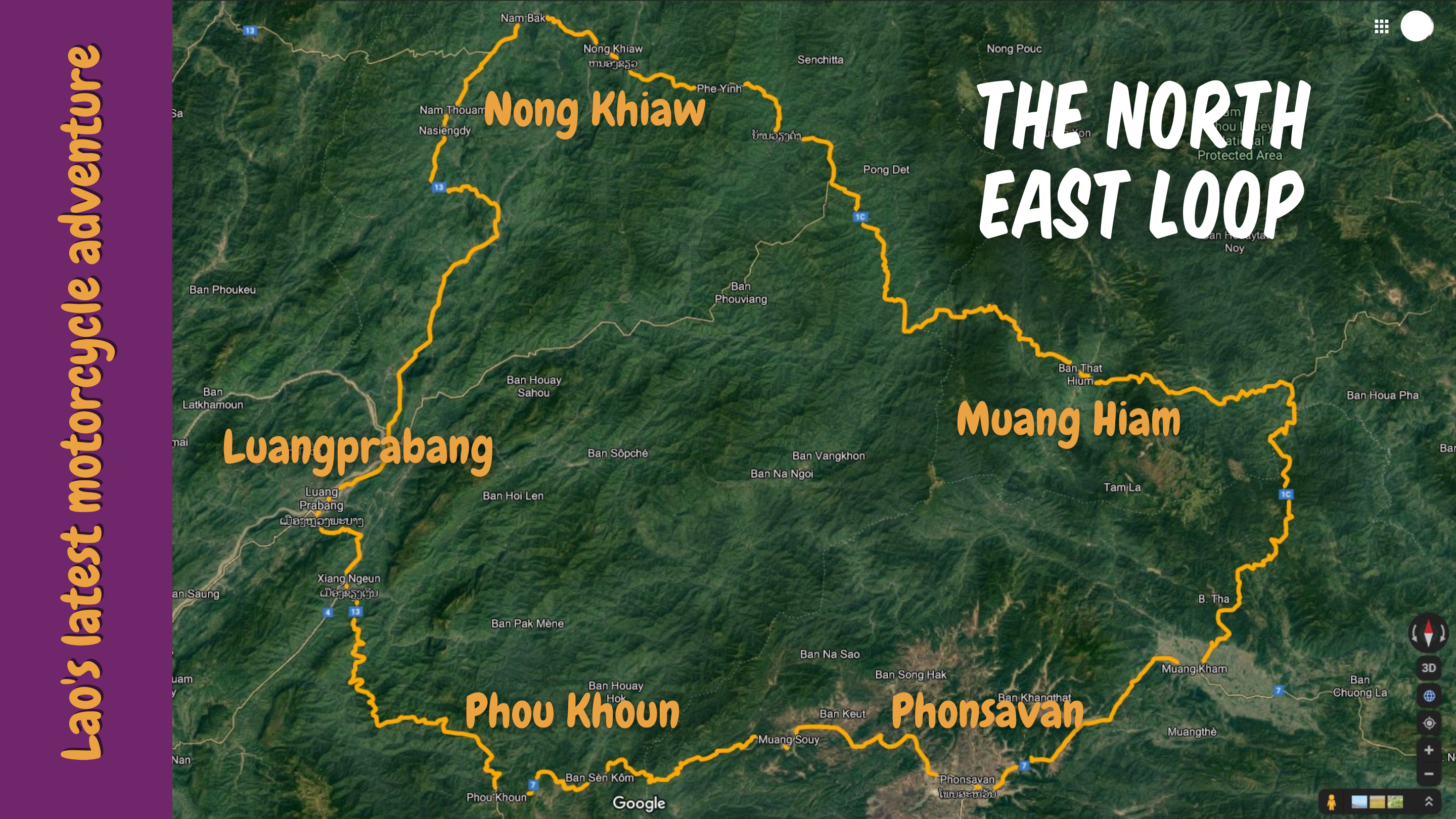
Luang Prabang to Nong Khiaw
Distance: 140 kilometers
Time: Around four hours if riding slowly
Road Condition: Good by Lao standards. Paved with some pot holes.
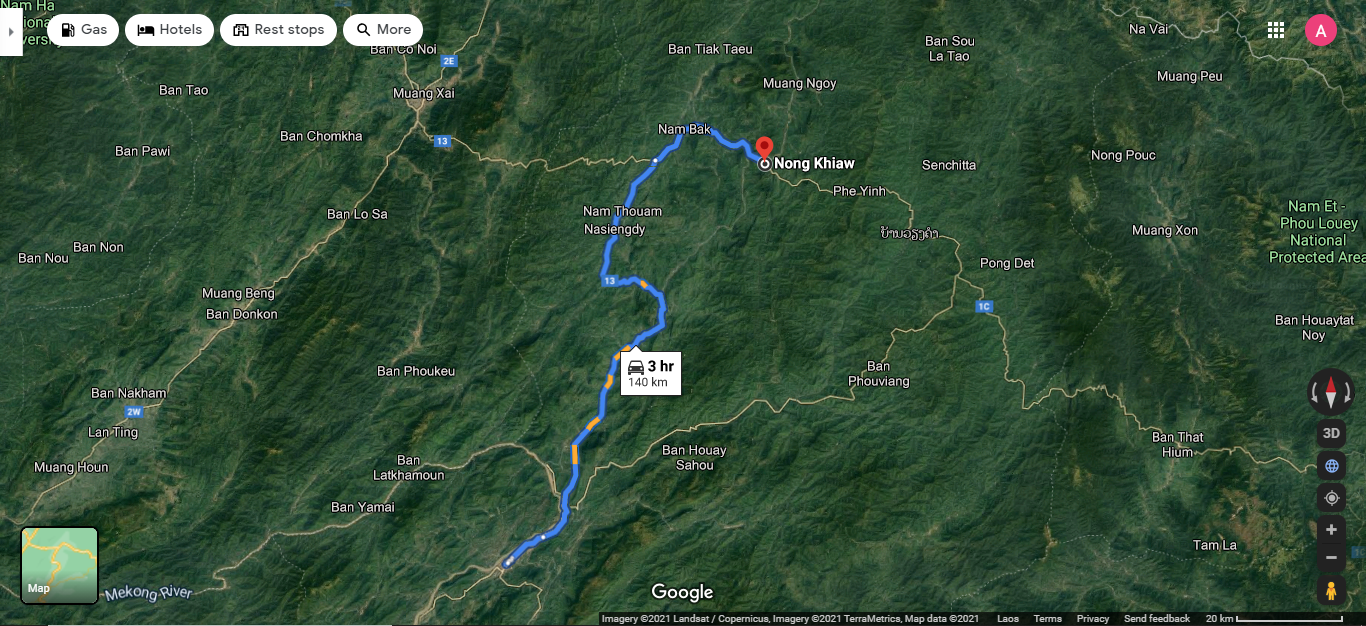
You’ll start by heading out of Luang Prabang on Route 13, heading north. Follow the road as it runs parallel to the Mekong River, before crossing over the Nam Xuang River. Continue along Route 13 as it heads north through a small valley before crossing over the Nam Ou River. The road then along the edge of the Nam Ou, making it’s way north to the tiny town of Pak Nga. Here the road veers away from the river and heads east in parallel with the Nam Nga River. The road crosses the river and swings north, taking you to the town of Pak Mong. At Pak Mong turn off Route 13 and on to Route 1C, heading north east. Continue on this road as it weaves its way through valleys before following it along the edge of the Nam Bak River before joining the Nam Ou as it flows past the town of Nong Khiaw.
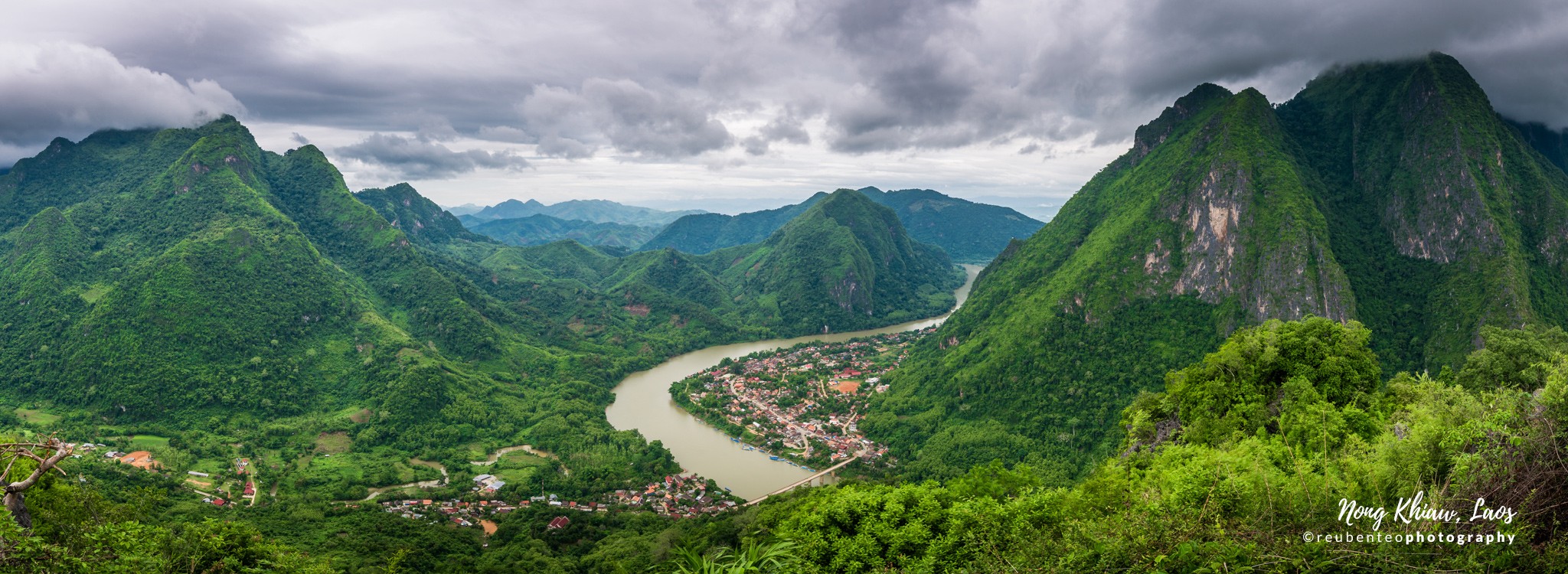
Nong Khiaw
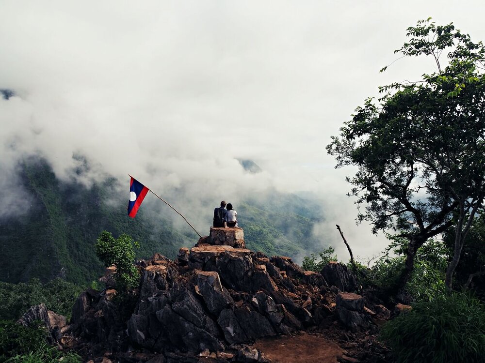
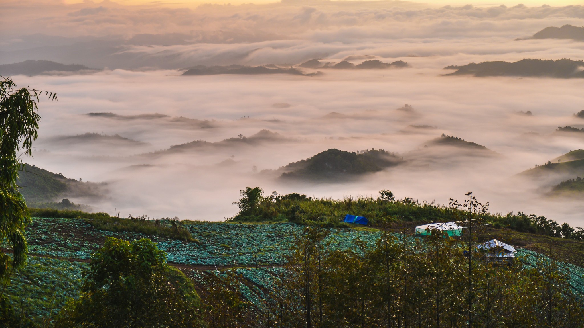
A quaint little town built along the edge of the Nam Ou River, this town has become increasingly popular with travellers over the last five years. The town boasts a range of accommodation from simple bungalows to upscale resorts, a wide variety of food. It is a popular ecotourism destination, being starting point for many hikes and kayak tours. One of the most popular activities is climbing up to the lookout at the top of the Pha Daeng Mountain for sunrise. The view from the lookout is one of the best in Laos and at sunrise you stand above a sea of clouds that fill the valleys below. It is an incredible way to start the day and an absolute must if you plan to spend the night in Nong Khiaw. For more information on Nong Khiaw, click HERE.
Nong Khiaw to Muang Hiam
Distance: 167 kilometers
Time: Five to six hours if riding slowly and taking breaks
Road Condition: Good by Lao standards. Paved with some potholes. Lots of corners, but not too much traffic
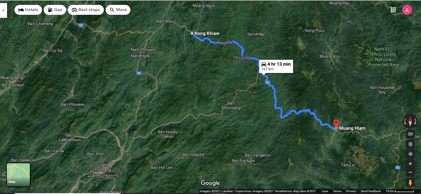
Head out of town, crossing the bridge over the Nam Ou River, and travel south east along Route 1C. The road will shortly begin climbing up the hill to the small village of Phe Yin, before descending down to the small village of Ban Bom Vang, on the banks of the Nam Xuang River. The road follows the river for a short while, passing through small villages and a few basic shops. The road crosses the river before making a steady climb up along a ridge to a collection of small villages. You will pass by Ban Viengkham, the district capital that has petrol station, some restaurants and guesthouse. In the village of Ban Ka Deun you pass an intersection with a rough dirt road that goes to back to Luang Prabang (an option for experienced riders only). Stop at the intersection to buy some fruits at the market, have a cool drink or a noodle soup. Ride past this intersection and continue to follow Route 1C as it heads south and begins to descend to the Nam Xeng River. The road follows the river for a short while before climbing over a small pass and continuing alongside another small river, before turning east to begin the climb up into the forested mountains. A series of switchbacks and tight corners lead you ever higher into the mountains. A short descent, quickly followed by another climb of switchbacks and then some wide sweeping corners take you down into the valley of Muang Hiam. Follow Route 1C as it crosses the river and takes you into the centre of the small town.

Muang Hiam
Muang Hiam is the district capital and home of the Nam Et-Phou Louey National Park (NEPL NP) Information Centre. Here you can learn about NEPL NP and the work they are doing to conserve some Lao’s most endangered species. The town has a few local guesthouses that are clean but basic. Close to town there are a number of waterfalls that can be visited, but they require some technical riding on dirt tracks. There natural hot springs, the highlight of Muang Hiam, can be accessed via a 45 min jungle hike or a short ride on a good quality dirt road. The Nam Khan River flows through the town, and there is a very nice, if somewhat rustic, restaurant on the western bank of the river, just before the bridge. The town does not receive many tourists, but the people are warm and friendly. The main tourist attraction for foreigners is the NEPL NP Office, which can be a starting point for their many award winning wildlife ecotourism products. Click HERE to learn about visiting the NEPL Night Safari! For more information about Muang Hiam, click HERE.
& Nam Et-Phou Louey National Protected Area. Photo by NEPLNPA.
Muang Hiam to Phonsavan
Distance: 207 kilometers
Time: six to seven hours with plenty of breaks
Road Conditions: Good paved road with little traffic.
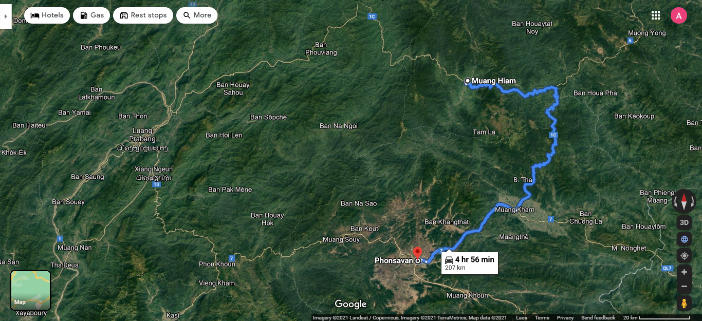
Follow the main road through town until you turn left at the large intersection to follow Route 1C up the hill. The road climbs gently up the mountain, winding its way east before a gentle descent down into a large valley ringed by towering mountains. At the bottom of the town you will pass through Ban Son Koua, the starting point of the NEPL NP’s Nam Nern Night Safari wildlife spotting tour (must be booked in advance with the National Park!). Cross the bridge over the Nam Neun River before climbing up and over a steep mountain. Turn right at Ban KoHing junction town and follow curvy road down to the town of Sop Lao (aka Nam Nern) on the banks of the Nam Nern River. Sop Lao is not a large town, but it can be a good place for a break, with a few noodle soup restaurants on the main street before the bridge, opposite the temple, and some larger local restaurants on the edge of the market. Market sells a large variety of the famous Houaphan skirts, renowned for their detailed paterns. Guesthouse and a gas station are also available in the village. From Sop Lao follow Route 1C south as it crosses the Nam Neun River and begins the long climb up to the ridge of the mountains the make up the eastern edge of Xiengkhouang Province. Follow the road along the ridge as it gently makes its way south, with large sweeping corners offering incredible views of the valleys below. Eventually you will start to descend into the large valley of Muang Kham.
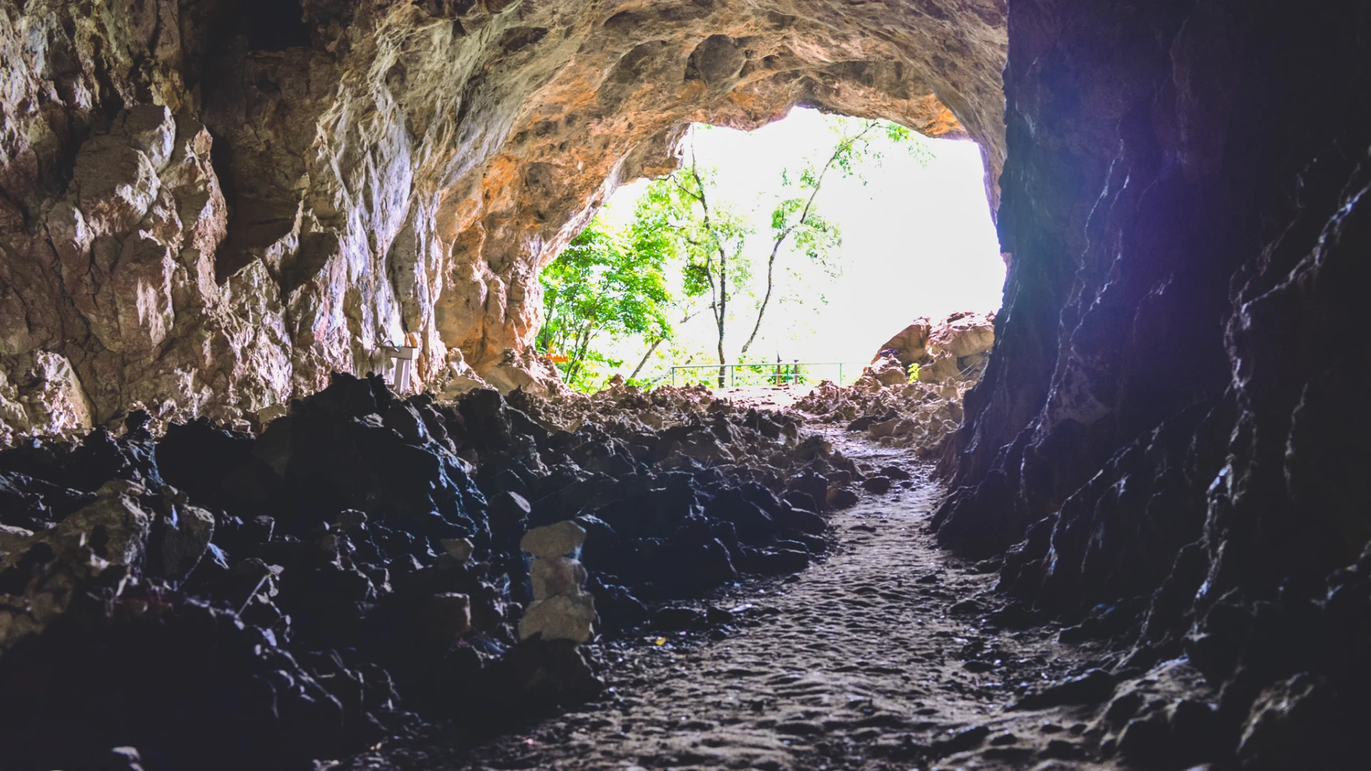
One of the most sombre sites on this route is Tham Piew Cave, where 374 people, sheltering from incessant bombing by U.S. Fighters, died after an American fighter fired a rocket into the cave and killed everyone inside. This is a very significant site for Lao people and worth visiting on your way through. Tham Piew Cave is just north of Muang Kham, accessible via a paved road coming off Route 1C.
Muang Kham is a large town with shops, restaurants and various tourist attractions, including several hot springs. Follow Route 1C all the way through town until it reaches a T intersection with Route 7. At the intersection there is a large park with a bust of Kaysone Phomvihane, first leader of the Lao People’s Revolutionary Party and the first Prime Minister of the Lao PDR. There are a few restaurants around this park, so it is a great place for a break. If you feel that you have ridden far enough for the day there are also some guesthouses in town, a hot spring resort just out of town, and a rustic eco lodge on the banks of the nearby river.
From the park, turn right onto Route 7 to head west along the valley floor. The road will climb up the head of the valley before plateauing onto the Phonsavan plane. Follow the road as it makes its way into the centre of Phonsavan town.
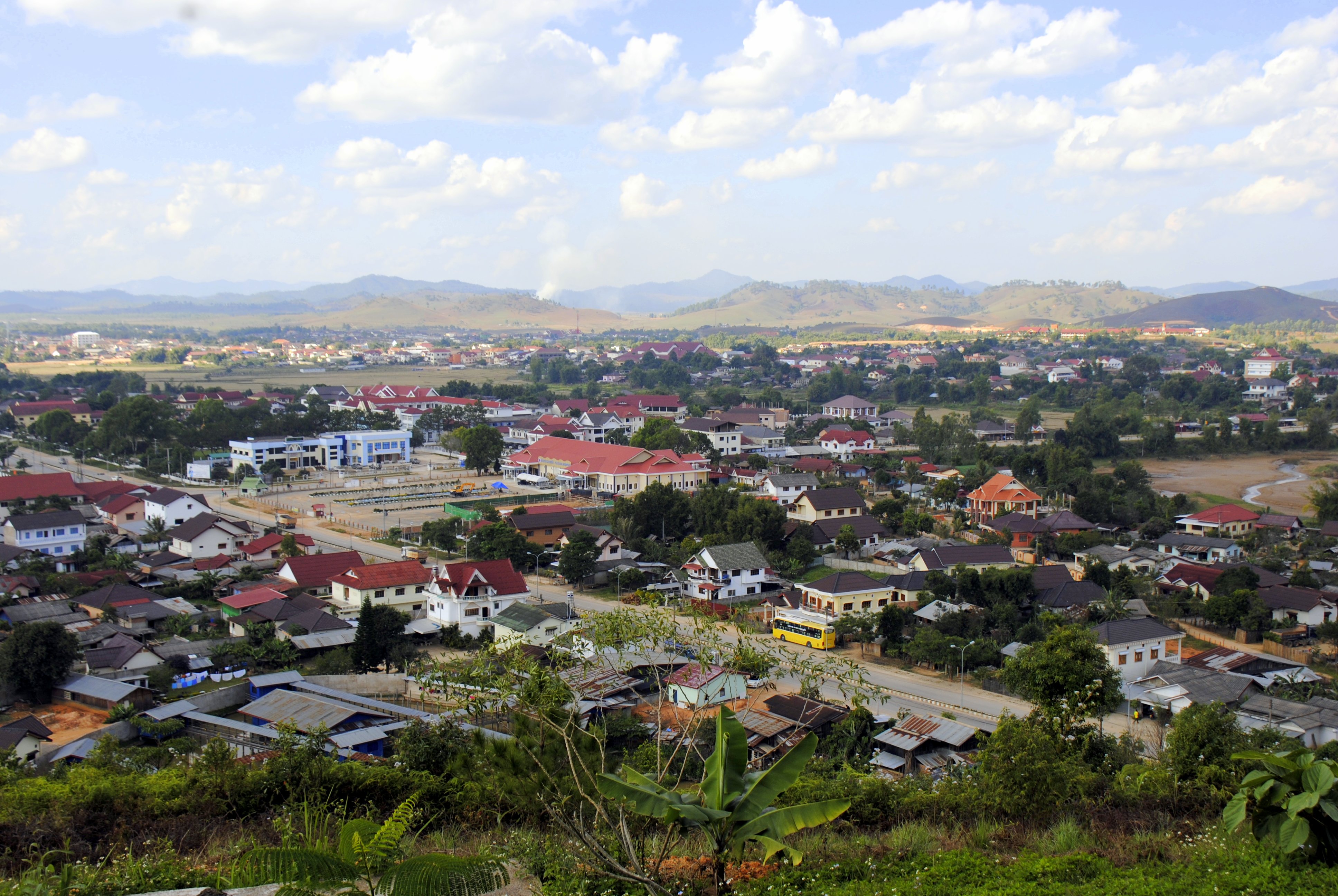
Phonsavan
Phonsavan is the provincial capital of Xiengkhouang Province and is a large city. It is most famous for the Plain of Jars, a collection of megalithic stone jars that have puzzled historians and archelogists for centuries. Recently listed as a UNESCO World Heritage site, these jars are a popular tourist destination. However Phonsavan offers explorers so much more than just the ancient stone jars. By staying an extra day, visitors can explore villages nearby offer some unique crafts. The noodle making village is renowned for their excellent handmade noodles, while the Spoon Making Village recycles bomb casings from U.S. bombers and smelts them into spoons and other tourist mementos. Staying in town you can visit a number of mine clearance NGOs’ visitor centres to learn more about the war in Laos and its ongoing impacts, or visit the incredible provincial museum which showcases the history and ethnic groups of the area. Travel further afield and visit Long Chien, a secret CIA airbase which was once the busiest single strip airport in the world, while at the same time did not appear on any official map. Or immerse yourself in nature with the Pakheo Hike, and overnight adventure deep into the jungle. This town is often overlooked by tourists, but offers a whole range of activities and is well worth exploring for a few days. For more information about visiting Phonsavan, click HERE.

Phonsavan to Phou Khoun
Distance: 136 kilometers
Time: four to five hours with plenty of breaks
Road Conditions: Good paved road with little traffic, but lots of tight corners.
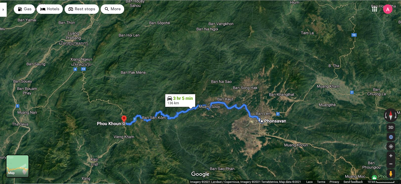
Start the day by riding out of town, heading west along Route 7. The road is quite flat, winding its way through the rolling hills of the Xiengkhuang plains. The road here is quite new and in good condition, with wide sweeping turns and very little traffic. After about an hour the road starts to climb up a small hill, and goes through a series of switch backs and hairpin turns. At the top of this hill there is a great view of the valleys and mountains to the south, before the road starts to make its way down through more switch backs and hairpin turns, to the small town of Ban Nam Chat. Here the road crosses a small stream before beginning a long climb of tight turns taking you to the top of the mountain range. Once on top of the hills the road follows the ridge, making its way through many small Hmong villages. This stretch of road is incredibly scenic, with vast panoramic views of the valleys below. There is one more short climb, followed by a short descent before the road gently climbs the last stretch to Phou Khoun
Phou Khoun
Phou Khoun is a very small little town built on top of a mountain. It offers sweeping views of the surrounding countryside, but very little else. There are a few basic restaurants, a local market selling food, and some clean but basic guesthouses. On the edge of town there are some incredible viewpoints and some camping resorts, with great views of the sunset. The strawberry farm, offers sweeping views of the landscape to the south, with dramatic mountains and karsts rising from the plains below. For more information about visiting Phou Khoun, click HERE.
Phou Khoun to Luang Prabang.
Distance: 128 kilometers
Time: four to five hours with plenty of breaks
Road Conditions: Ok paved road with some traffic, but lots of tight corners.

The last days ride starts by winding its way north, across the mountain tops along Route 13. You will ride through a number of tiny villages before the road swings west to make a short descent through sharp hairpin corners into a valley. Continue along Route 13 out of the valley, up to another ridge that slowly climbs to a small village on top of a mountain with impressive views of the rice fields below. Here the road begins a long descent of sharp corners, down to the Nam Ming River. The road crosses the river before climbing back up out of the valley, through more tight corners to a small Hmong hilltop village. The road then begins its final descent towards the Nam Khan River and the town of Xiang Ngeun. Here you continue along Route 13 as it follows the Nam Khan towards the Mekong River and Luang Prabang. Just before Luang Prabang the road turns away from the Nam Khan to cross a small mountain before finally descending into the ancient royal capital of Luang Prabang.
After five days of riding through the north of Laos, you will be thrilled to be back in the comfort of Luang Prabang. Take some time here to check out the sites, visit some temples, or maybe have a well-deserved massage!
We hope this guide has inspired you to get out and explore Northern Laos. We can’t wait for you to share your adventure with us through our social media channels so we can see all the great stuff you get up to. Until then, get out there and Discover Laos Today!